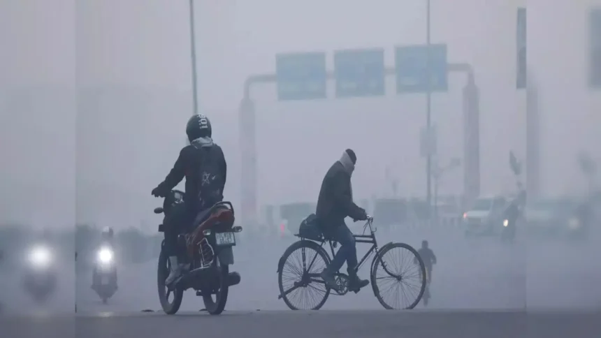
Delhi woke up to a colder morning on Saturday as winter tightened its grip on the Capital once again. With temperatures dipping further and clouds hanging low, the India Meteorological Department has issued yellow alerts for the weekend, warning residents to prepare for rain, thunderstorms, fog, and worsening air quality.
If you were hoping for a clear winter weekend, the forecast suggests otherwise.
Delhi Sees Further Dip in Minimum Temperature
Cold Mornings Make a Comeback
The Capital recorded a minimum temperature of 6.7 degrees Celsius on Saturday, which is one degree below the seasonal average. This marks a noticeable drop from Friday, when the minimum temperature stood at 7.7 degrees Celsius.
For many residents, the sharp chill early in the morning came as a surprise, especially after a brief period of relatively milder winter conditions earlier this month.
According to weather experts, the colder nights are the result of clear skies earlier in the week combined with cold winds flowing into the region.
Cloud Cover to Push Temperatures Up on Sunday
Why Sunday Night May Feel Warmer
While Saturday started cold, the IMD expects a significant change by Sunday. Increased cloud cover over the city is likely to trap heat near the surface, preventing temperatures from falling sharply overnight.
An IMD official said the minimum temperature on Sunday is expected to rise to around 11 to 13 degrees Celsius.
This sudden jump does not mean winter is ending. Instead, it reflects the influence of weather systems that bring clouds and moisture, which often lead to warmer nights but unsettled conditions during the day.
Yellow Alert Issued for Rain and Thunderstorms
Weekend to Remain Wet and Windy
The Met department has issued a yellow alert for both Saturday and Sunday, urging residents to stay cautious.
Under the influence of a third western disturbance this month, light to moderate rainfall is expected to continue across Delhi till Monday.
Weather officials said the city may experience one or two spells of light rain throughout Saturday. These showers could be accompanied by thunderstorms and gusty winds, with speeds reaching 30 to 40 kmph in some areas.
Such conditions could disrupt traffic, reduce visibility, and cause brief delays at airports and railway stations.
Fog Likely to Reduce Visibility
Early Mornings Could Be Risky
Along with rain and cloud cover, moderate to dense fog is also expected during the early morning and late-night hours.
Foggy conditions may affect road travel, especially on highways and near open areas. Drivers are advised to maintain safe speeds and use fog lights where necessary.
Flight operations could also face temporary disruptions if visibility drops significantly during peak fog hours.
Western Disturbance Driving the Weather Shift
What Is Causing the Sudden Change?
Western disturbances are weather systems that originate in the Mediterranean region and move eastward toward India. During winter, they play a major role in bringing rain, clouds, and colder conditions to northern India.
This is the third such disturbance affecting Delhi this month, and it has already altered temperature patterns and increased moisture levels in the atmosphere.
As long as the system remains active, cloudy skies, scattered rain, and fluctuating temperatures are likely to continue.
Air Quality Slips Further Into Poor Category
Pollution Levels Rise Despite Rain
While rain often helps settle dust and pollutants, Delhi’s air quality has continued to deteriorate.
On Saturday morning at 9 am, the Air Quality Index was recorded at 278, placing it firmly in the poor category. This marks a decline from Friday afternoon, when the 24-hour average AQI stood at 253.
According to pollution experts, calm winds and high moisture levels can trap pollutants close to the ground, reducing the immediate benefits of rainfall.
Very Poor Air Quality Likely in Coming Days
Residents Advised to Stay Cautious
Forecasts from the Air Quality Early Warning System for Delhi indicate that pollution levels may worsen further.
Air quality is expected to slip into the very poor category from Saturday evening and remain there until at least Monday. The outlook for the following six days suggests conditions could fluctuate between poor and very poor.
This means sensitive groups, including children, the elderly, and those with respiratory conditions, should limit outdoor activities, especially during early mornings and evenings.
How This Weather May Impact Daily Life
What Residents Should Prepare For
The combination of cold mornings, rain, fog, and poor air quality could affect daily routines in several ways.
Commuters may face slower traffic due to wet roads and reduced visibility. Outdoor plans may need to be postponed, and those with breathing issues should consider wearing protective masks when stepping outside.
Residents are also advised to keep themselves updated with local weather alerts and air quality bulletins over the next few days.
What to Expect Over the Next Week
No Immediate Relief in Sight
While temperatures may fluctuate, overall conditions are expected to remain unsettled for the next several days.
Cloudy skies, occasional rain, and pollution-related concerns are likely to dominate Delhi’s weather narrative through the start of the week.
A clearer trend may only emerge once the current western disturbance weakens and wind patterns improve enough to disperse pollutants.
Final Takeaway
Delhi’s winter is far from over. The Capital is heading into a weekend marked by cold mornings, rain-soaked days, foggy nights, and declining air quality.
While Sunday may feel slightly warmer overnight, the overall conditions demand caution, patience, and preparedness. Whether you are commuting, planning outdoor activities, or simply stepping out for daily errands, staying informed will be key in navigating the days ahead.