Delhi Weather Today: A Short Break from the Cold
Delhi residents experienced a slight relief from the winter chill on Friday as daytime temperatures rose above normal levels. The maximum temperature in the national capital touched 22.6 degrees Celsius, which is around half a degree higher than the seasonal average. This marked a noticeable improvement compared to the previous day, offering some comfort after a prolonged spell of cold mornings and fog.
However, this warmer phase is expected to be brief. The India Meteorological Department has warned that rain, thunderstorms, fog and gusty winds are likely to affect Delhi and surrounding areas over the next three days.
Temperature Trends Across Delhi
Day Temperatures Rise Sharply
The city’s primary weather station at Safdarjung recorded a significant jump in the maximum temperature, which was nearly five degrees Celsius higher than Thursday’s reading. Several other parts of the city also saw pleasant afternoon conditions.
Ridge reported a maximum temperature of 23 degrees Celsius, the highest in the city. Lodhi Road followed closely at 22.1 degrees Celsius, while Ayanagar recorded 21.6 degrees Celsius. Palam remained relatively cooler with a maximum of 18.5 degrees Celsius.
These readings indicated a temporary break from the biting cold that Delhi has been experiencing in recent weeks.
Nights Remain Cold
Despite warmer daytime conditions, nights continued to be chilly across the capital. Safdarjung recorded a minimum temperature of 7.7 degrees Celsius, which was slightly below normal for this time of year.
Palam was the coldest with a minimum of 6.7 degrees Celsius. Lodhi Road and Ayanagar both recorded 7.6 degrees Celsius, while the Ridge area logged a comparatively milder 9.5 degrees Celsius.
The contrast between warmer afternoons and cold mornings remains a key feature of Delhi’s winter weather.
IMD Forecast: Rain and Thunderstorms Ahead
Weather Change Expected from Saturday
According to the India Meteorological Department, the brief spell of warmth will give way to unsettled weather starting Saturday. Skies are expected to remain partly cloudy in the morning but may turn generally cloudy by afternoon or evening.
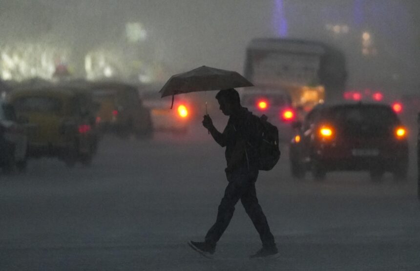
The department has predicted the possibility of very light rain accompanied by thunderstorms, lightning and gusty winds during the night hours. Wind speeds could range between 30 and 40 kilometres per hour in some areas.
Fog to Return in Morning Hours
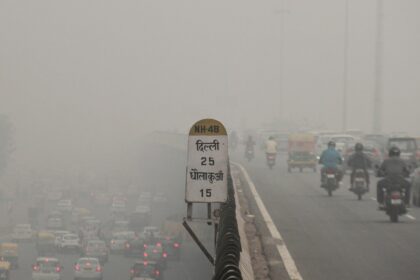
Morning fog is also expected to make a comeback. IMD has forecast moderate fog at many places, with dense fog likely at isolated locations during early hours over the next few days.
This could impact visibility on roads and rail routes, especially during early morning travel. Commuters are advised to remain cautious and plan journeys accordingly.
Temperature Outlook for the Next Few Days
Cooler Days Likely
The Met department expects maximum temperatures to remain in the range of 20 to 22 degrees Celsius over the coming days. Minimum temperatures are likely to hover between 6 and 8 degrees Celsius.
While the overall weather may feel slightly cooler due to cloud cover and rain, extreme cold conditions are not expected immediately.
Air Quality Remains a Major Concern
AQI in Poor Category
Even as temperatures fluctuated, Delhi’s air quality remained a cause for concern. The city’s 24-hour average air quality index stood at 253 on Friday, placing it firmly in the poor category.
In the evening hours, air quality deteriorated further across several locations. Around 22 monitoring stations recorded poor air quality, eleven stations were in the moderate category, and four stations slipped into the very poor range.
Wazirpur recorded the worst AQI reading at 318, indicating very poor air conditions.
Morning Air Quality Snapshot
During the morning hours, pollution levels ranged from poor to very poor across the city. Nineteen stations reported poor air quality, twelve were in the moderate category, and eight recorded very poor conditions.
RK Puram logged the worst AQI in the morning with a reading of 316, highlighting persistent pollution hotspots in the city.
Understanding AQI Categories
According to the Central Pollution Control Board, air quality levels are classified as follows:
An AQI between 0 and 50 is considered good
51 to 100 is satisfactory
101 to 200 is moderate
201 to 300 is poor
301 to 400 is very poor
401 to 500 is severe
Prolonged exposure to poor and very poor air quality can cause respiratory discomfort, especially for children, elderly people, and those with pre-existing health conditions.
What Is Driving Delhi’s Pollution?
Transport and Industry Major Contributors
Data from the Decision Support System shows that Delhi’s transport sector contributed up to 15.7 per cent of the city’s pollution load. Emissions from vehicles continue to be one of the largest sources of air pollution in the capital.
Industries located in Delhi and nearby areas contributed around 12.5 per cent to the pollution levels.
Other Pollution Sources
Waste burning accounted for 1.4 per cent of the pollution load, while construction activities contributed two per cent. The residential sector added around 3.9 per cent, largely due to cooking emissions and heating practices during winter.
These figures highlight how multiple smaller sources collectively worsen air quality, especially during stagnant winter weather conditions.
NCR’s Role in Delhi’s Air Pollution
Neighbouring Districts Add to Pollution Load
Pollution in Delhi is not just a local issue. Several neighbouring districts in the National Capital Region also contribute significantly.
Sonipat accounted for 13.4 per cent of the pollution load, followed by Jhajjar at 13.1 per cent. Rohtak contributed 2.4 per cent, Panipat 2.1 per cent and Gurugram 1.2 per cent.
These figures underline the regional nature of air pollution, where emissions from surrounding areas affect air quality in Delhi.
Air Quality Expected to Worsen Despite Rain
Warning Issued for Coming Days
Despite the forecast of rain and thunderstorms, air quality may not improve significantly. The Air Quality Warning System has predicted very poor air quality levels from January 31 to February 2.
Cloudy conditions, low wind speeds and temperature inversion during winter often trap pollutants near the surface, limiting the cleansing effect of light rain.
What Residents Should Keep in Mind
Health and Travel Advisory
With fog, rain and poor air quality expected, residents are advised to take precautions:
Limit outdoor activities, especially early mornings and late evenings
Use masks if sensitive to pollution
Follow traffic advisories during foggy conditions
Stay updated with weather and air quality alerts
People with respiratory issues should remain especially cautious during this period.
Delhi enjoyed a brief break from the winter chill on Friday as temperatures rose above normal levels. However, this relief is expected to be short-lived, with rain, thunderstorms, fog and gusty winds forecast over the next three days.
At the same time, air quality continues to remain in the poor category and is expected to worsen further in the coming days. As winter weather patterns continue to fluctuate, residents are advised to stay informed, plan ahead, and take necessary health precautions.